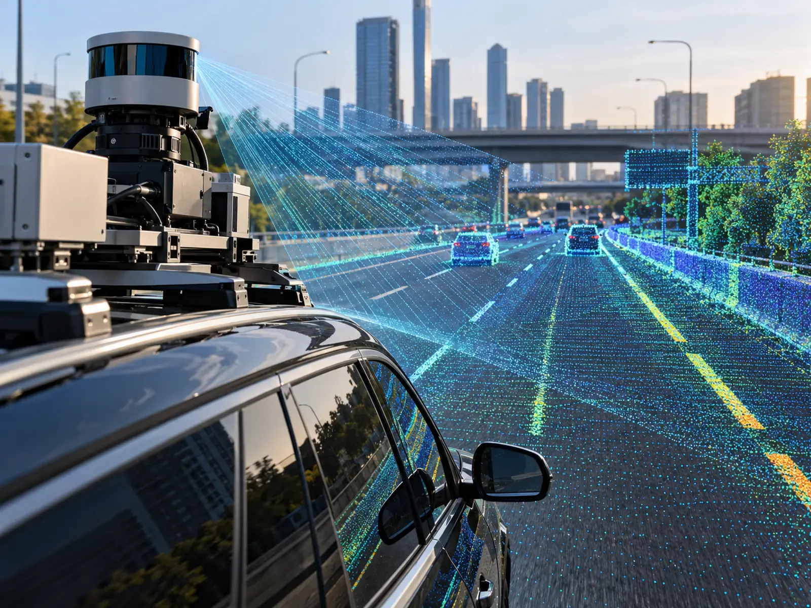
No single sensor sees everything that matters on a road. A conventional digital camera records visible surface features. Three-dimensional laser imaging describes geometry and depth. Infrared sensing measures thermal patterns that can reveal certain anomalies. Positioning and inertial sensors help relate those observations to physical locations and the movement of the inspection platform. FHWA's nondestructive-evaluation resources similarly treat pavement inspection as a field containing multiple complementary technologies rather than one universal measurement method.
That is the logic behind multi-sensor road inspection. The goal is not to add hardware for its own sake. It is to combine useful measurements so road owners receive a clearer condition picture.
What digital imaging does well
High-resolution imagery is the most intuitive inspection layer because an engineer can visually review the recorded surface. Digital imagery supports documentation and image-processing workflows, and FHWA also describes the use of high-resolution photography for identifying and mapping visible structural defects such as cracks in bridge applications.
For pavement inspection, systematically captured images can document cracks, potholes, patching, surface deterioration and road markings. Georeferencing makes those observations more useful because a team can associate each image with a specific part of the road network.
Computer vision can further screen large image collections for recurring patterns. The limitation is important, however: visible-light imagery primarily captures what can be seen at the surface. Illumination, shadows, water, debris and image quality can affect the observation.
Where LiDAR and three-dimensional imaging add detail
Three-dimensional pavement imaging measures geometry rather than relying solely on colour or texture. FHWA describes laser-based 3D pavement systems that use projected illumination and imaging geometry to calculate the depth of points on the pavement surface. Such systems can support distress evaluation and measurements where surface shape matters.
LiDAR point clouds can also represent road and roadside assets through dense three-dimensional coordinates. FHWA transportation-management guidance notes that point clouds can provide information about assets such as lanes, guardrails, barriers, signs, lighting and pavement features, although the volume of point-cloud data can create storage and processing challenges.
Recent FHWA research has also demonstrated automated LiDAR workflows for pavement-marking detection and condition assessment, illustrating how mobile and airborne LiDAR can produce GIS-ready infrastructure information.
For road managers, the benefit is dimensional context. Where a normal image provides appearance, three-dimensional measurements can provide additional evidence about shape, depth or deformation.
What infrared thermography can reveal
Infrared thermography measures differences in emitted thermal radiation at the surface. FHWA identifies pavement applications including the detection of delamination and debonding and the identification of thermal segregation during asphalt construction. Because material properties and defects can influence heating and cooling behaviour, thermal images can reveal anomalies that are not obvious to a normal camera.
But infrared is not a universal subsurface detector. FHWA guidance notes that sunshine, wind, moisture, shadows, equipment calibration, survey conditions and time of observation can influence results. Potential defects may still require follow-up investigation.
That is exactly why infrared works naturally within a multi-sensor approach: it contributes a different form of evidence rather than attempting to replace every other inspection technique.
Why positioning and motion data matter
A detected defect has less operational value if a repair crew cannot reliably find it again.
Roadinteli's planned platform includes GPS and an inertial measurement unit alongside its imaging sensors. The IMU captures the motion of the imaging system to improve the quality of the output images.
Positioning is also critical for repeat surveys. Road owners may want to establish whether a crack has expanded, a depression has worsened or a repaired area has begun deteriorating again. Comparing measurements through time becomes more useful when the observations are consistently associated with the same physical location.
The value comes from fusion, not sensor count
Multi-sensor inspection works best when the final output is easier to interpret than the raw inputs.
A maintenance manager should not need to become an expert in camera imagery, thermal maps, point clouds and inertial data merely to decide which road segment deserves attention. The processing layer should translate those inputs into a coherent record: location, condition observation, available dimensional evidence, confidence or quality indicators, and the maintenance context required for review.
Roadinteli is developing a system that combines digital, infrared and LiDAR cameras with GPS, an IMU, artificial intelligence and machine learning.
That architecture fits a broader engineering principle reflected across FHWA's inspection resources: different sensing methods answer different questions.
The best multi-sensor inspection platform, therefore, is not necessarily the one with the longest equipment list. It is the one that turns complementary measurements into clearer, more defensible maintenance decisions.
Sources
- FHWA — 2D and 3D Imaging Technology (opens in a new tab)
- FHWA — Infrared Thermography (Pavements) (opens in a new tab)
- FHWA — High-Resolution Digital Photography (opens in a new tab)
- FHWA — Considerations of Current and Emerging Transportation Management Center Data, Chapter 2 (opens in a new tab)
- U.S. DOT ITS JPO — Complete Pavement Markings for Safe and Complete Streets (opens in a new tab)
- FHWA InfoTechnology — Pavements (opens in a new tab)